THE LAND OF THE RIVER
The flow of the Po River formed the Po Valley. Transporting earth and sand for thousands of years it has built the territory of Ferrara. In the final part of its course, the Park of the Po Delta came to life. The lives of inhabitants of the Delta have always been influenced by the events on the river and the changes in its course. Also, the formation of new hotbeds generated new possibilities for settlements along its banks, and therefore economic and social development, leaving traces of past civilizations. In this way, the Po has been a resource for water supply, fishery, irrigation and as a way of communication. But the Po hasn’t always been so generous: the population had to survive periods of flooding and those of drought, adapting itself to the will of the river. The attention that has been dedicated in the past to the river and the precaution we take today will grant to towns a more serene and secure life.
Today the Po and its Delta, preserved by wise management of the territory, generate more wealth and preserve a fascinating landscape of natural beauty. For these reasons, the Po Delta joins "Ferrara, City of the Renaissance and its Po Delta" as a UNESCO World Heritage Site. It is a dynamic environment, still in evolution, where nature is free to give new land or recover parts of it. The mouth of the great river is the perfect location for many species of aquatic birds where man is only a guest observer.
THE WOODS OF MESOLA
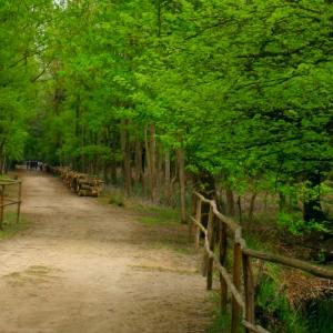
In the territory of Mesola survive some vestiges of coastal forests dating back to the Middle Ages that originally extended to the mouth of the Tagliamento. Among these, the Natural Reserve Bosco della Mesola, the largest forest area of Ferrara, is best known for its Mesola Deer, also known as Deer of the Dunes, the only descendant of the Red Deer that originally inhabited the Po Valley. The wood developed on a system of ancient sand dunes with the typical vegetation of the Mediterranean macchia, consisting mostly of oaks. There three routes of different lengths are accessible to the public, easily identifi able thanks to the signs. The last testimony to the great forest of the Estense Estate is represented by the Grove of Santa Giustina, where the absence of ungulates allows the renewal of dense undergrowth, a refuge for numerous birds. A network of trails allows you to cross it from the Po di Goro until the XVIth century Torre dell'Abate.
The town of Mesola, framed by its pine woods and river, is what remains of the ambitious urban project that the Este planned to counter the military and commercial power of Venice in the Adriatic. The Estense Castle, half fortress and half luxury home, now houses exhibition and conference activities including the Museo del Bosco e del Cervo della Mesola, illustrating the evolution of the territory of Mesola. The pine forests scattered throughout the area and the “fossils Dune” of Massenzatica, located in the hinterland, are valuable evidence of the evolutionary history of the Po Delta dating back to the Xth century BC.
THE PO DI GORO AND ITS MOUTH
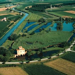
Along the fl ood plains bordering the river Po in the territory of Berra, in the place known as the Gateway to the Delta, you'll arrive at the first fork in the river. Walking on the embankment or better sailing a small boat, you can see a well-preserved habitat characterized by stagnant water and fl ooded basins which were dug long ago for the extraction of clay, rich in fl ora and fauna. Following the Po di Goro, a river of great naturalistic value, you encounter some meanders formed as a result of the abandonment of the bed by the river. Of great interest for birdwatchers is, towards the mouth, Valle Dindona that features, in its dry part, an interesting riparian forest typical of areas which are regularly flooded. During spring, on the white willows, you can see numerous herons and cormorants while the large reedbeds become an ideal habitat for several species of ducks.
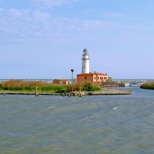
Near Gorino, you can find one of the last pontoon bridges that connects the Venetian and Emilian shores, a wooden structure resting on concrete barges. Immense reed beds precede the outlet to the sea where you'll fi nd the Scannone di Goro, also known as the Island of Love, once the refuge of lovers who met here far away from prying eyes. On this island of sand, the Goro Lighthouse stands, built in 1950 and accessible only by boat.
THE SACCA DI GORO
The Sacca di Goro is one of the largest brackish lagoons of the Northern Adriatic; the Scannone di Goro, a recently formed strip of sand where a characteristic lighthouse rises, partially separates it from the sea. The presence of fresh and salt water, low water depths and other ecological peculiarities allow the settlement of important plant communities. Extended reed beds and grasslands of Glasswort, Sea Lavender, Sharp Rush, Beachgrass and Puccinellia become the inevitable habitat for numerous species of birds such as sandpipers, oystercatchers, water pipits, grebes, herons, terns and gulls. Through the years, thanks to the shape of the Northern Adriatic coast, it was possible to take advantage of the lagoons for fish farming but after the great reclamation works of the last 150 years, the area has radically changed and today the Sacca di Goro represents an important reminder of delta environments that once reigned supreme.
Currently the Valli di Gorino and part of the Valle Goara are the only basins still used for the traditional fi shing of eel, shrimp and fl ounder, while the biggest share of the lagoons' area is exploited for the breeding of clams that since the mid-eighties represent the most signifi cant part of the local economy. Goro, once a small settlement of cane huts situated on the right bank of the Po, is a quaint fi shing village today with a modern marina which also boasts interesting tourist activities. There are numerous opportunities for navigation which aid the visitor in the discovery of this environment of transition between land and sea. Along the way, you can see the Lanterna Vecchia, which once lit the way for sailors, and the Lighthouse of Goro.
THE PO DI VOLANO AND ITS MOUTH
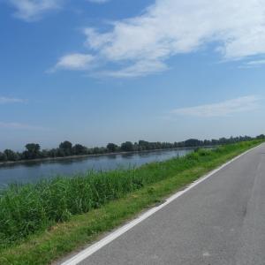
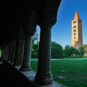
For millennia, the history and traditions of the land crossed by rivers have been linked to navigation and daily trade. Along the bank of the Po di Volano went traditional pack animals transporting goods, hence the name “Tiraglio”, and the current left bank that connects Migliarino to Migliaro retraces the ancient route: today it is a nice pedestrian and bicycle route along which you can admire glimpses of rural landscapes and mansions. In Massa Fiscaglia, the ancient tower Torre Tieni signaled the passage of goods at the time of the Este family. Codigoro welcomed the river into the heart of its town center and the Bishop's Palace reflects on it. Towards the sea, the Po di Volano flanks the monastic complex of the Abbey of Pomposa, one of the most important centers of spirituality in medieval times.
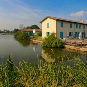
Of the vast complex of lagoons that the river once formed down to the sea, the last relic is represented by Valli Canneviè-Porticino, today a protected natural oasis. The imposing tower Torre della Finanza, located in the small town of Volano, signals the proximity of the mouth of the river; there you can reach the Taglio della Falce. Reeds and rushes are the dominant element of this landscape where many environments, very different from each other, follow one another in rapid sequence: the Po di Volano, the pinewood, called Pineta di Volano, and swamps alternating with sand dunes, and then the beach. The swamp Palude della Peschiera, communicating with the Sacca di Goro and the Natural Reserve Bosco della Mesola increase the natural beauty of the area.
RECLAMATION AND THE COUNTRY
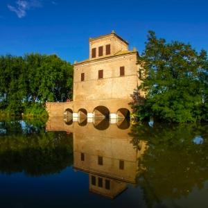
The centuries-old struggle between man and environment is documented by the large hydraulic engineering works to wrest land from the sea. Numerous historical structures illustrate these interventions: the sluice Chiavica dell’Agrifoglio, built in the late XVIIth century to drain the shallow waters of the territory of the Pomposa abbey, or Torre dell'Abate, built to drain the high waters of Mesola, both working with a “vinciane” door system. With the invention of the steam engine, reclamation work got a great push forward: from the late XIXth century, with the construction of the water-scooping pump station in Codigoro, which is still active today, the town became the most important propeller center, draining thousands of hectares of brackish soil. Recently opened, the Ecomuseum of Reclamation of Lagosanto, housed in a disused pumping station, is an important example of industrial hydraulic archeology: inside, the Casa della Memoria testifies, in addition to mechanical reclamation, the effort of hundreds of workers, the “scariolanti”, who toiled the land and made an enormous contribution to the progess of reclamation in the Provincia di Ferrara.
All the territory of Ferrara, once characterized by lagoons and swamps, is today largely agricultural. Human activity has reshaped what the rivers had created over the centuries by supplementing natural areas, with the landscape of reclaimed areas covered by collectors and channels that mark the regular shape of the farms. These flat lands are basically clay and especially suited to the cultivation of grains and forage in general. In the last century, there was a widespread sugar beet cultivation, but today rice is the most widespread, especially in the area of Jolanda di Savoia, where the high volume of water, through a network of channels, and the peaty soil, rich in organic substances, help this crop thrive.


